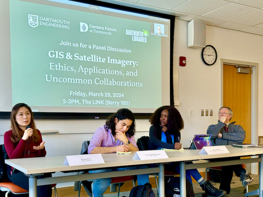
Guest panelists included Assistant Professor of Engineering Xiaoyao Fan, Assistant Professor of Geography Luis Alvarez León, Adjunct Assistant Professor of Geography and Director of the Citrin Family GIS/Applied Spatial Analysis Laboratory Jonathan Chipman, and PhD Candidate Saima Shikesho in the Ecology, Evolution, Environment, and Society Program.
Sol Diamond, an Associate Professor of Engineering and Director of the Design Initiative at Dartmouth, moderated the panel. He had the panelists explore the role of geospatial surveillance technology in the past and present and for the future.
The panel broadly considered and offered questions such as
How do we chart a path toward using technology to benefit all humans?
Who has the power, and what are the ramifications of technology like Geographic Information Systems (GIS)?
How might GIS do more harm than good, as it can amplify disparities, contributing to human conflict and war?
“The social side of things become really important... you can’t neglect to think about that when looking at data,” said Jonathan.
Similar questions were asked of engineering students Luc Cote, Elise Donovan, Dylan Lawler, Mara McCollor, and Kendall Weingart on their project “Automated Mapping of !Nara in Namibia’s Ephemeral River Corridors” in Thayer’s Engineering Design capstone courses ENGS 89/90.
The team worked with imagery from the National Geospatial Intelligence Agency in conjunction with data gathered through Dartmouth’s collaboration with the Gobabeb Research and Training Centre in Namibia. Together with Xiaoyao, whose research focuses on image processing, computational modeling, and machine learning, the team developed an algorithm that would correctly identify !nara melons as an indicator of climate change in the Namib Desert.
Saima, one of our guest panelists and a researcher who advised on the subject, shared the importance of “understanding community dynamics, including climate change and the animals living in this ecosystem, and how the ecosystems have been changing.” She explained that she and the students used satellite images to do that.
She cautioned, though, by asking “The information we generate in these systems, who does it belong to? The locals who live among where the information was taken, or is it only the people with money or hierarchal power that can access and hold that information?” Remote communities, like those in the Namib Desert, are often at a disadvantage and unable to access the data and information gathered. So, asking questions repeatedly like, who benefits from the information generated? Or, how is that data utilized by individual actors, particularly for profit, and not necessarily in the community’s best interest from where that data was taken?
Luis urged us to “develop a critically informed practice because it’s not just about critiquing the technology; it’s about understanding how it works and how not to use it. That happens through practice and by opening [the proverbial] black box. This leads to understanding how various players could use this technology across the socio-economic and political landscape.” He cautioned, “Some actors bear more responsibility than others in how they use GIS (policing, surveillance, facial recognition, etc.), but that’s not necessarily the technology’s fault.”
Jonathan, who, with Xiaoyao, was a co-advisor for the ENGS 89/90 project, was enthusiastic about adding that critically informed layer.
The liberal arts atmosphere helps broaden how we consider the bigger picture when teaching and learning at Dartmouth, particularly in engineering.
When Sol asked about what the next five to ten years might look like for sensor technology, like GIS, Jonathan shared that the types and number of sensor technologies will diversify. However, “the more interesting question is where is data analysis going? So much of this work is human-led, not AI-led. Where we’re headed is how humans interact with AI to analyze spatial data rather than humans doing it entirely themselves. This is where Dartmouth is well positioned: to do that machine learning by bringing together all the subject matter expertise needed.”
Xiaoyao extended this thought by stating, “Deep learning models require humans to label them - that requires [human] expertise.”
In closing, Luis answered Sol’s question by asking his own, “Can we become producers who steer this conversation in a more responsible manner, helping curb the more harmful impacts of these technologies and boosting the very real positive applications they can have?” For Saima, that looks like bridging the gap between the satellite and the ground. With better imaging and observations “we’d have a better system for understanding our ecosystems, particularly in the face of climate change.”
Thanks to Jentry Campbell and Lucinda Hall, both Research & Learning Librarians, for helping make this event possible in collaboration with the Director of Cook Engineering Design Center at Thayer, Emily Monroe, P.E., and Sol Diamond from the Thayer School of Engineering.
Special thanks go to the Centers Forum at Dartmouth for funding the event under their 2023 - 2024 theme, Uncommon Collaborations: Dialogue Across Difference. The Libraries are proud to host and partner on interdisciplinary engagement and the uncommon collaborations the Centers Forum supports.